Walking trails
Looking for a different place to walk?
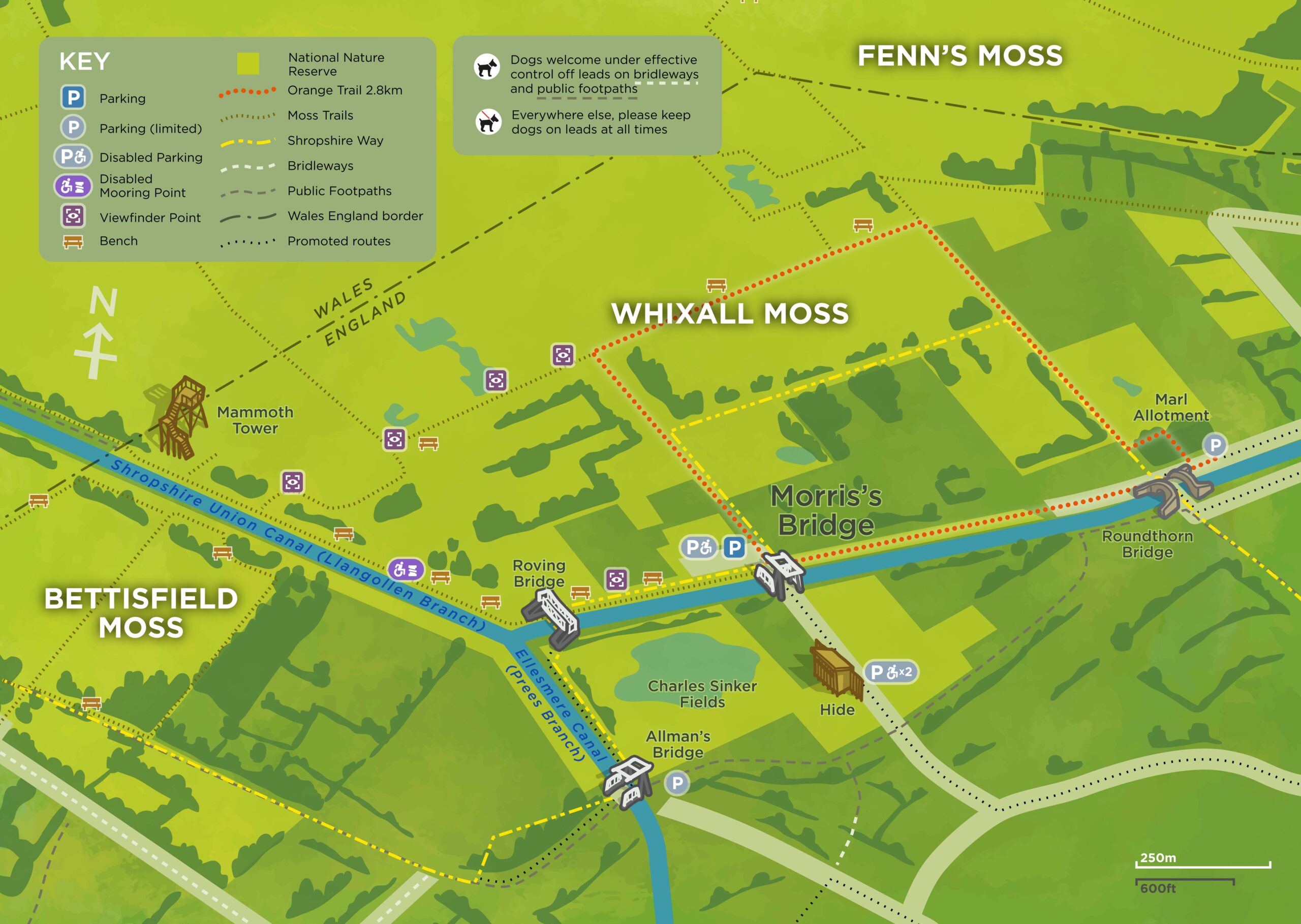
You can experience the beauty, tranquillity and wide range of wildlife for yourself in a visit to the Marches Mosses by following one of many walking trails: Here is a map of all the trails.
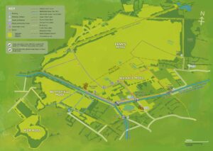
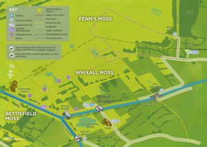
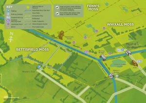
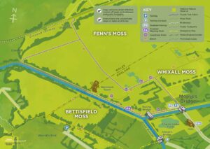
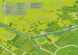
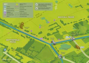
Combined Trails map
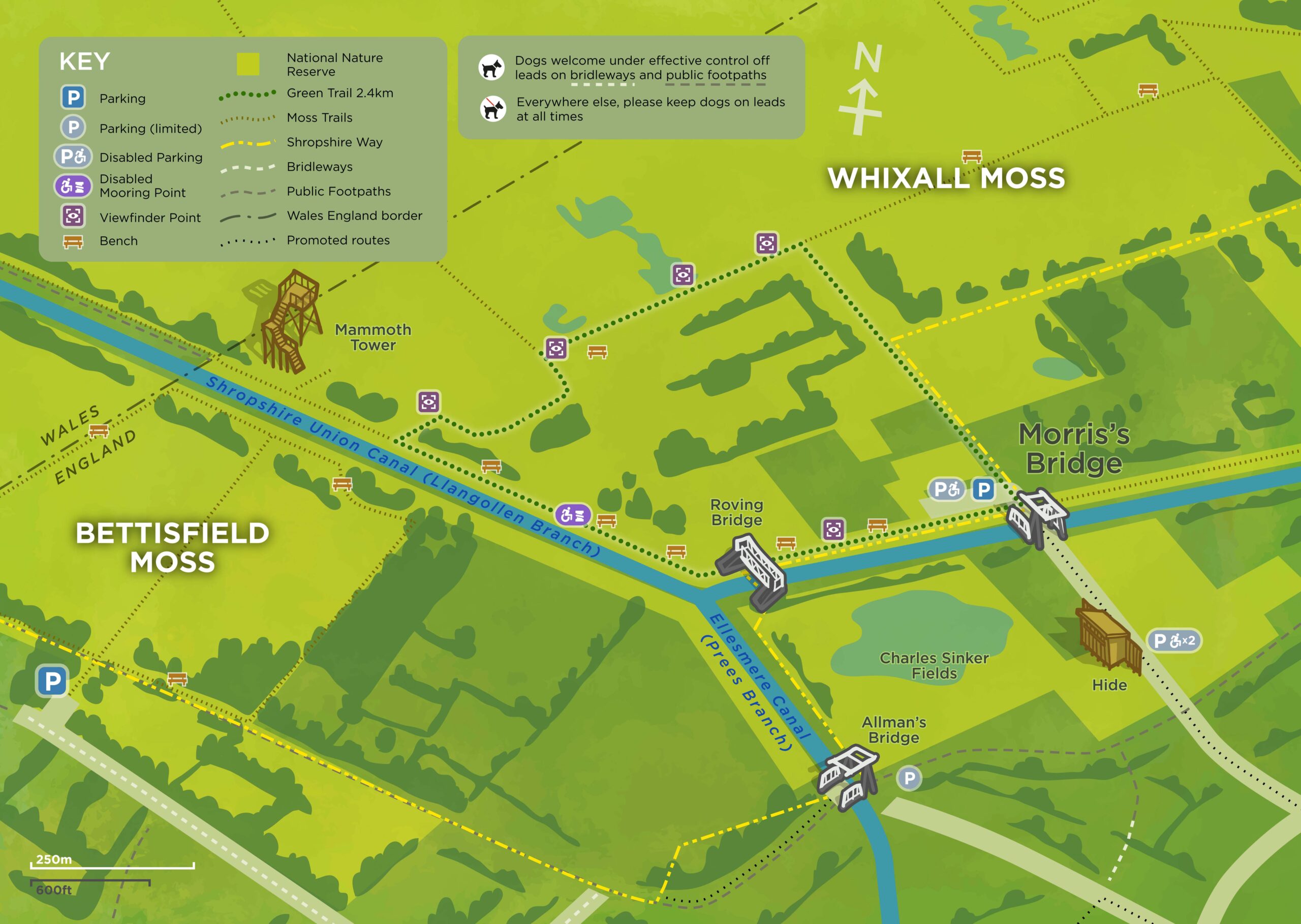
The Green Trail
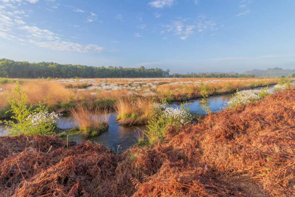
Follow the trail from near Morris’ Bridge car park on a 1.5 mile circular route. On current maps, this trail is indicated in green. A number of viewfinders are to be found along this trail, including one at the former scrapyard. Look through these to discover more about the history of the Mosses, its wildlife and myths, along with some great outlooks over the mosses. As you walk, pay attention for curlews, lapwings and other birds flying overhead. You can find The Green Trail in the Fenn’s and Whixall Visitor leaflet here. You can view the trail map full size here.
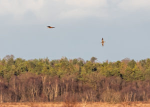
Curlews Over Marches Mosses Credit: Stephen Barlow
Green Trail map
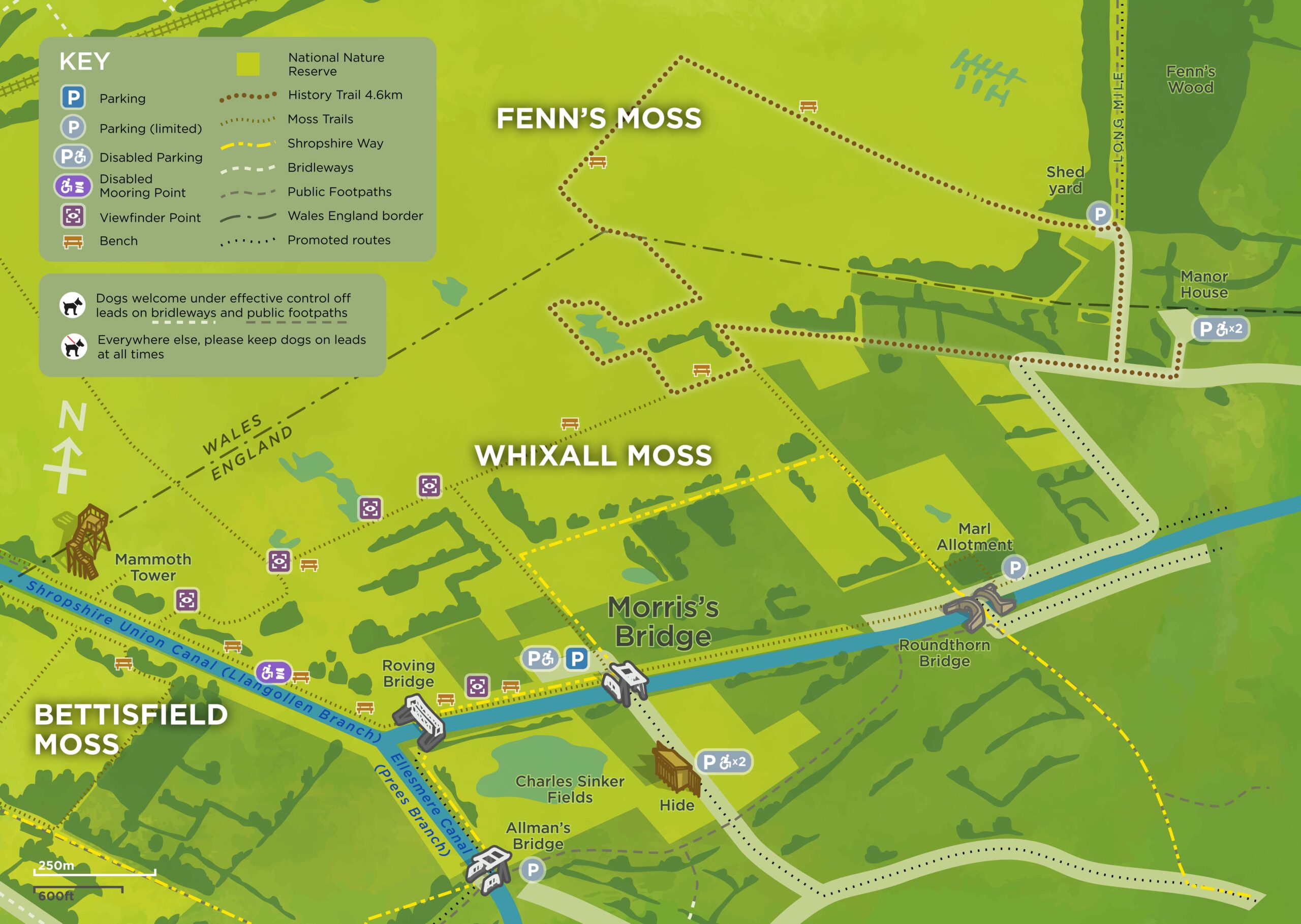
Fenn’s and Whixall Mosses History Trail
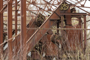
Learn about the history of the Mosses – the peat cutting, by hand and commercially, how the peatland was used in both World Wars, and even about the bodies in the bog. Click here for the full size map.
The Natural England brochure that you can read as you follow the History Trail is here.

Peat cutters’ pattens (overshoes to prevent sinking into the peat)
History Trail map
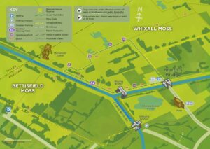
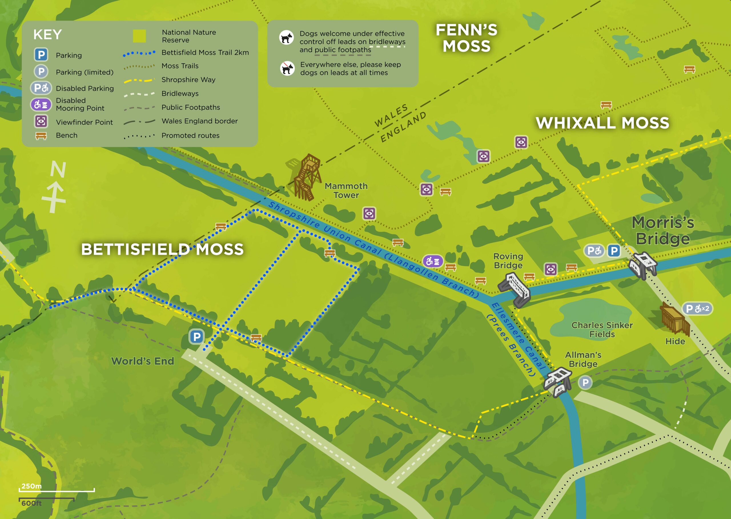
Bettisfield Moss Trail
This 2km (1 ½ miles) trail takes about an hour to walk. You’ll spot a variety of plants, many of which thrive only in the peatland conditions of the Mosses and you’ll likely see birds overhead and, if you look closely, butterflies, beetles and other invertebrates that live on Mosses. Click here for the full size map.
You can find the details of the trail here: Bettisfield Moss Trail.
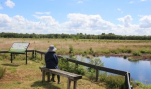
Lookout over Bettisfield Mosses
Bettisfield Trail map
The Purple Trail
At 3.6km, the longest of the Mosses trails makes a circuit through Whixall Moss, passing close to Fenn’s Old Works, a listed monument. It’s a great place to look for butterflies and other wildlife, or just take in the wide open sky above you. Click here to view the map full size.
The Fenn’s and Whixall Visitor leaflet is here.
Credit: Paul Harris
Purple Trail map
The Orange Trail
On this 2.8km trail, expect to see a wide range of trees along the canal section of the walk, with lots of chances to see wildlife such as Yellow Brimstone, Water Voles, Raft Spiders, Snipe and Adders once you get onto the mosses. Click here for a full size map of the Orange Trail.
The Orange trail can be found in the Fenn’s and Whixall Visitor leaflet here.
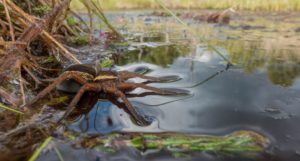
Raft Spider Credit: Stephen Barlow
Orange Trail map
The Mammoth Trail
The Mammoth Trail is a 2.25km trail that is more accessible. There are disabled parking spaces on Morris Bridge Car Park, from where you can go up an accessible ramp to the canal towpath which will take you to the Mammoth Tower viewing platform. The trail can be tough terrain for those with mobility issues, escpecially during poor weather. Click here for a full size map of the Mammoth Trail.
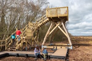
Mammoth Tower Credit: Paul Harris
Mammoth Trail map
Bring your wellies and please keep your dog on a lead
The trails are well signposted and level and easy to walk. They’re often wet, so be sure to bring your wellies or boots. You’re welcome to bring your dog along for a walk, but you’ll need to keep Fido on a lead, as there are ground-nesting birds throughout the Mosses, as well as some water hazards. Please take your litter – and any dog mess – home with you.
Please read these posters before you begin your walk on the Mosses:
Bringing your dog to the Mosses – English and Welsh
Adders Living on Marches Mosses
Birds Breeding on Marches Mosses
We hope you enjoy your visit to the Marches Mosses!


